CARRUCAN HOLDINGS IN THE ELTHAM AREA
When Patrick Carrucan died in 1894, the Application for Probate listed his Eltham holdings as follows
1. Land being lot 460 and part of lot 19 of Portion 12 section 4 at Eltham Parish of Nillumbik containing 5 acres 1 rood 24 perches. Shire Valuation £200.
2. Land being lot 53 Portion 12 Section 4 Nillumbik containing 2 perches upon which is erected an old WB and slat house containing 6 rooms. Shire valuation £140.
3. Land being Lot 2 Section 18 Nillumbik containing 61 acres upon part of which there is an orchard and part of grass land. Shire valuation £800.
4. Land being part of Crown Portion 12 Section 4 at Eltham containing 3 acres 1 rood and 28 perches. Shire valuation £200.
5. Land at corner of Dalton and Bible Streets Eltham containing 2 acres 2 roods 10 perches. Shire valuation £100.
6. Land being lots 1 and 2 Section 12 at Eltham containing 2 acres. Shire valuation £100.
7. Land being Allotment 5 Section 12 at Eltham Parish of Nillumbik containing one acre 2 roods 21 perches, upon which there is an orchard. Shire valuation £60.
These were not the only Carrucan land holdings around the Eltham area at that time, as the following two parish maps attest. Note these maps are very high resolution and will take a while to download.
Map of the parishes of Greensborough and Nillumbik, 20 Mar 1882
On the lower right hand side of the 1882 map are shown three allotments (allotments 7, 6 and 5) just outside the township of Kingstown (now Panton Hill) and held by P. Carucane, Susan Carucane & Michael Carucane. Kingstown is now known as Panton Hill. These would presumably be Patrick Carrucan's children Patrick (then aged 18), Susan (then aged 21) and Michael (then aged 23). They would presumably have been purchased by these Carrucan children, with help from their father Patrick.
Link to this map: http://search.slv.vic.gov.au/primo_library/libweb/action/dlDisplay.do?vid=MAIN&reset_config=true&docId=SLV_VOYAGER2178654
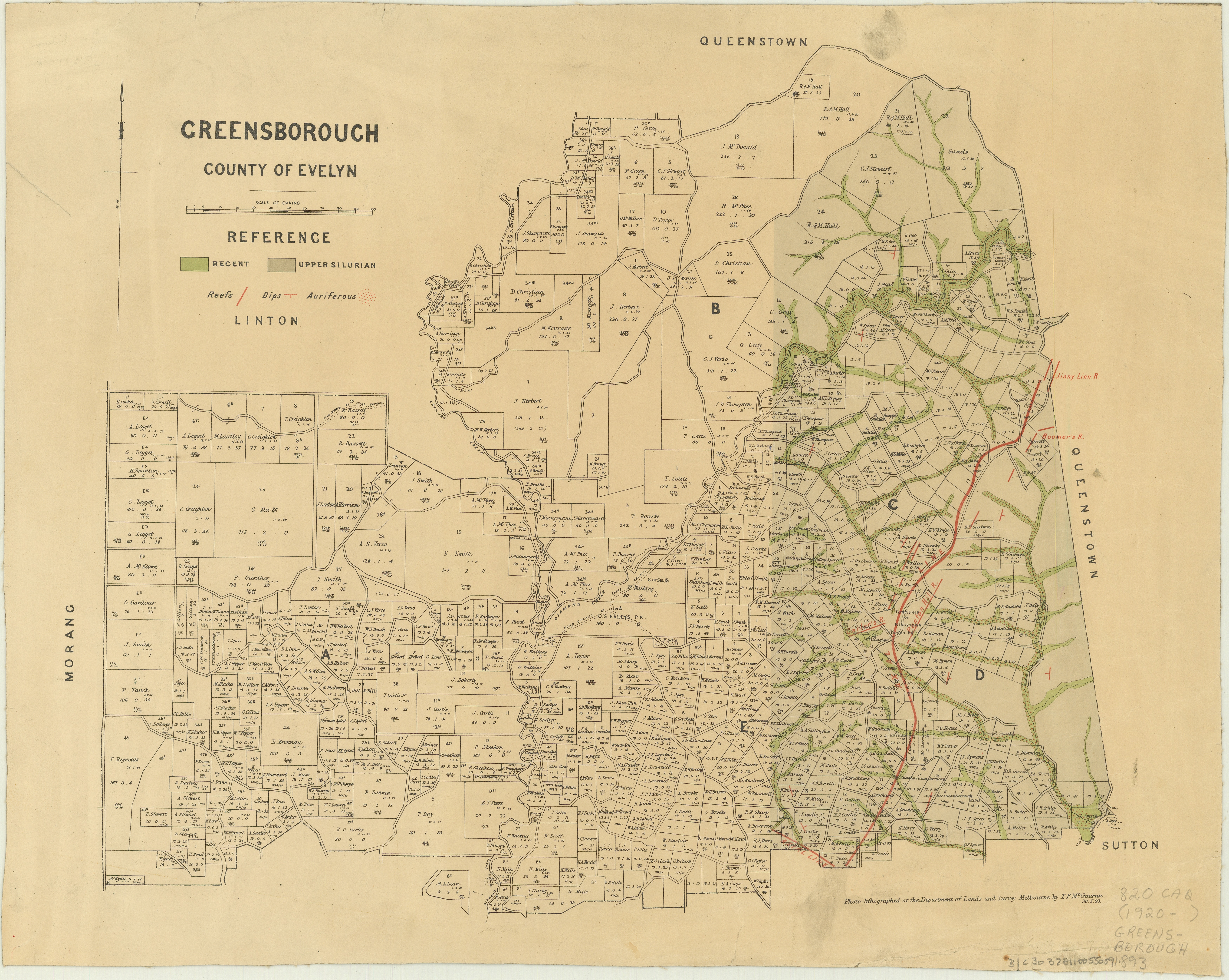
Map of the parishes of Greensborough and Nillumbik, 30 Mar 1893
This map still shows the 3 lots mentioned above in the bottom right of the map, but they are now shown as allotments 6, 5 and 4. The identical measurements confirm them as the same blocks. Below and adjoining these lots are five new lots (which had been opened up in the intervening years) with Carrucan names, but only two have lot numbers (40 & 41). These five new allotments are allocated to P. Carrucan, J. Carrucan, M. Carrucan, H. Carrucan & P. Carrucan.
Since so many of the same family names reoccur, it is difficult to determine exactly which Carrucan children owned these new allotments. It is likely that J. Carrucan was James and that H. Carrucan was Hannah, two of Peter Carrucan's children.
Link to this map: http://search.slv.vic.gov.au/primo_library/libweb/action/dlDisplay.do?vid=MAIN&reset_config=true&docId=SLV_VOYAGER1854273